Location is the one kind of data that almost every other kind ends up joined to. An order, a customer, a mobile tower and a flood all happen somewhere.
A map is a dataset, like the ones sold in Market Segment 8.3, Market research and market intelligence providers. It is gathered from satellites, aircraft, cars and surveyors. It has to be updated all the time, because roads, buildings and shops keep changing. And it is sold on subscription.
A map is also software. Companies use it to ask questions of their own data by place:
- Where are our customers?
- Where is our mobile network weakest?
- How far will the flood reach?
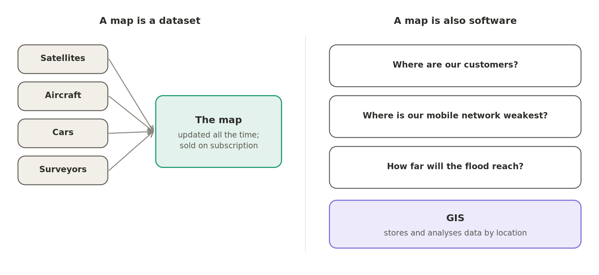
Software that stores and analyses data by location is called a geographic information system, or GIS. The data itself is called geospatial data: data about places on the earth.
The buyers are companies whose business depends on place. They include carmakers, delivery and logistics companies, governments, electricity and water companies, retailers, insurers and telecom operators.
The best-known maps, Google Maps and Apple Maps, are covered elsewhere.
Every company named here has posted software engineering jobs in India. Famous companies that don't actively hire software engineers in India are left out.
This Market Segment has two sub-segments:
Keep reading, free
Two more sections are on this page: The map itself and The ground seen from above. Sign in to read them here, in full.
Continue with Google- The map itself
- The ground seen from above
Back to the online store from the start of this Market Segment. Its delivery partner's vans follow routes planned on a digital map. That map, and the software that plans on it, is sold by the companies in this sub-segment.
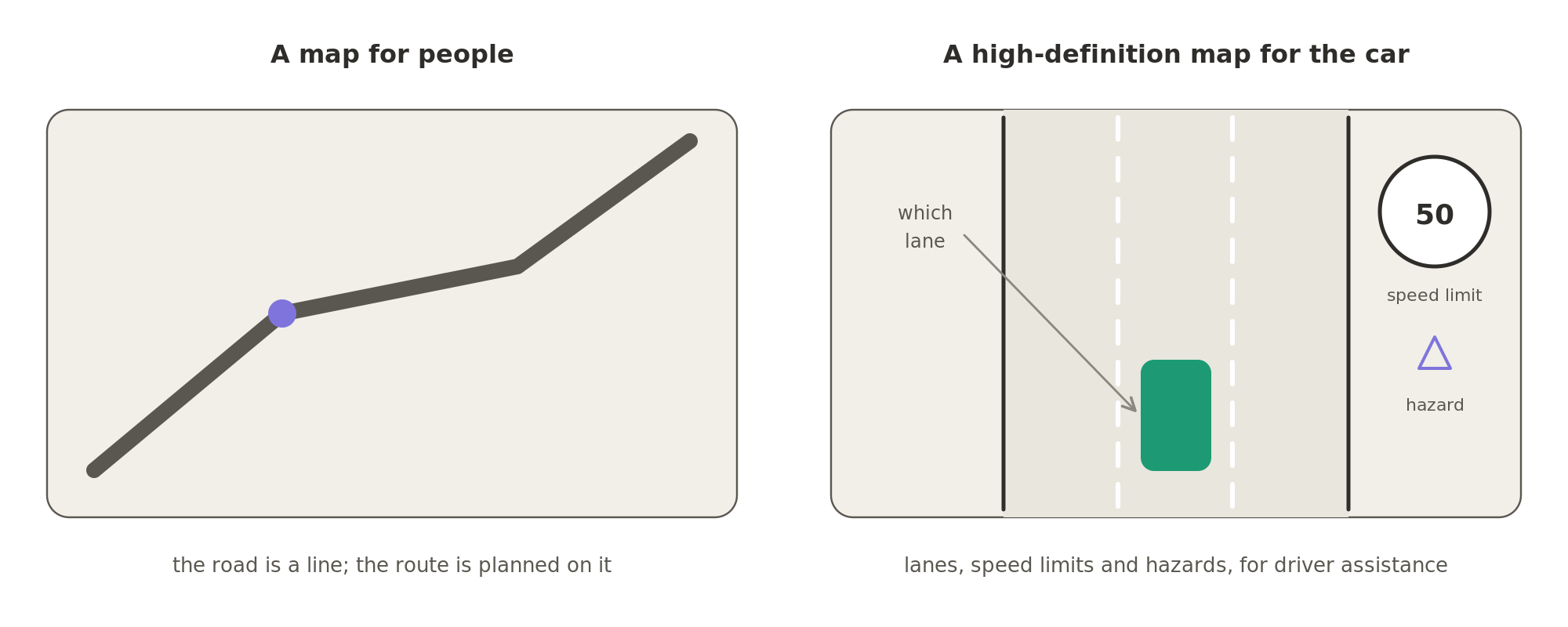
- High-definition maps, detailed enough for a car to know which lane it is in.
- Speed-limit and hazard data for driver assistance: the features that warn the driver, or help the car steer and brake.
- A location platform, through which a fleet or logistics company uses the same map, for example to plan delivery routes.
HERE's Mumbai team works on its map and location platform.
TomTom, Mapbox and Foursquare are not covered in this Market Segment.
A map shows what is where. It can't show how much earth was dug out of a mine this month, or whether a roof was damaged in last night's storm. For that, someone has to look from above, with drones, aircraft or satellites. Geospatial AI is software that reads these images and measures things from them automatically.
Two companies covered mainly in other Market Segments use the same kind of data for their own industries:
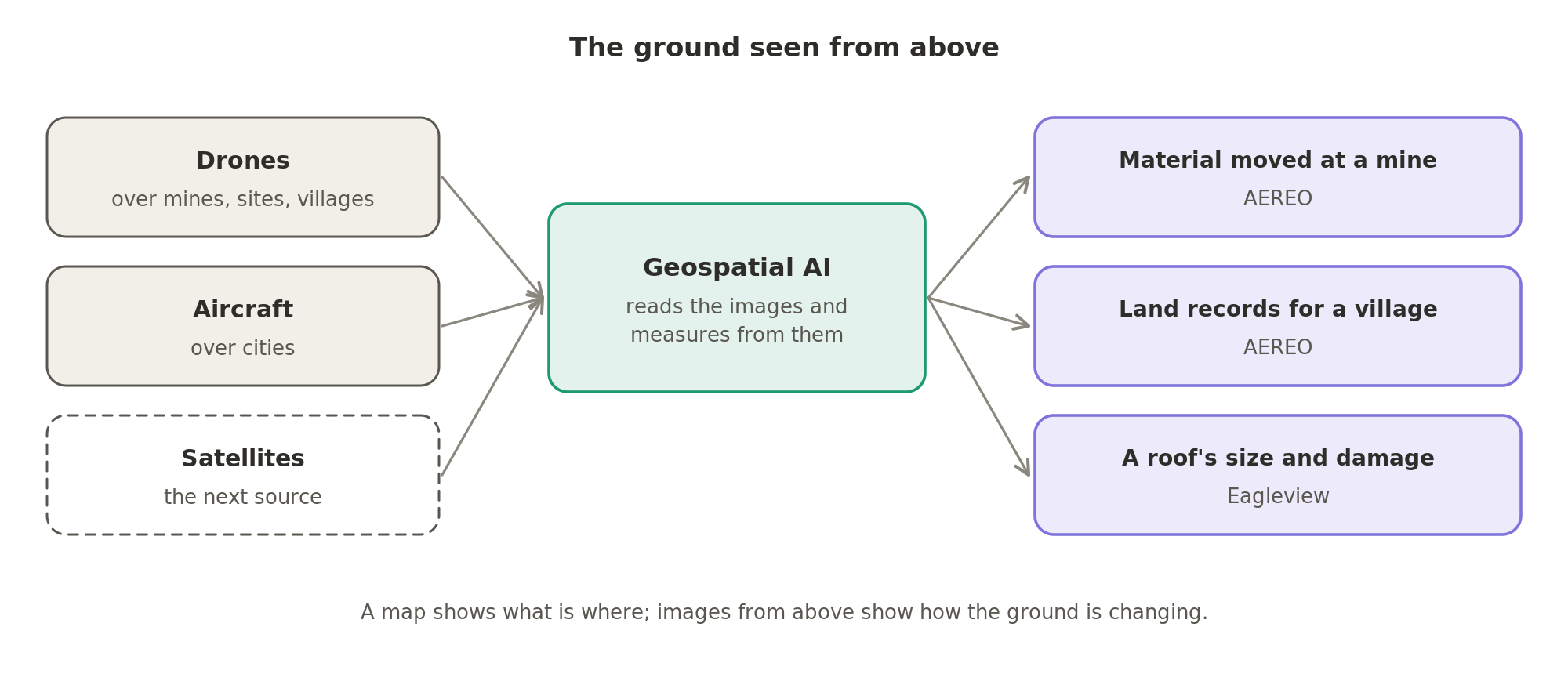
Maps used to be surveyed by people on the ground. Now they are increasingly worked out automatically. The sources are the cameras in every car, the drone over the site and the aircraft over the city, and AI models read the images. HERE's high-definition maps and
Who these companies hire, and for what, is on What analytics and data providers hire for.