ingrid.fyi India's software hiring trends, explained.
Sign in to ingrid.fyi with Google
Your Google account
name@gmail.com
Continue with Google
Home / Product companies / X · Industrial tech and mobility / Aerospace, defence and space / Earth observation and space surveillance
On this page
Earth observation and space surveillance Eyes in orbit, watching the Earth and the objects around it The weather map on the evening news, with a cyclone moving towards the coast, is a satellite picture. Satellites that watch the Earth are called Earth-observation satellites. They are different from the satellites that carry internet and phone signals. (More on those in Market Segment 1.5, Satellite and wireless communications, in Industry Vertical 1, Networking and telecom.)

How a satellite sees. Earth-observation satellites carry three main kinds of sensor:
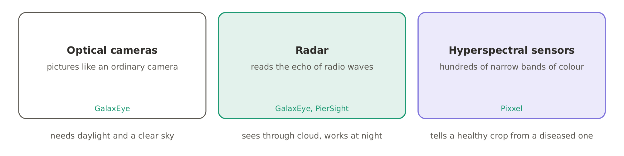
Optical camerastake pictures like an ordinary camera. They need daylight and a clear sky. Radarsends out radio waves and reads their echo. It sees through cloud and works at night. This matters in India, where much of the country is under cloud during the monsoon. Hyperspectral sensorssee hundreds of narrow bands of colour, far more than the eye can. Each material, such as a healthy crop, a diseased one, or a mineral, reflects these bands in its own way. How a satellite sees: optical cameras take pictures but need daylight and a clear sky, radar sees through cloud and at night, and hyperspectral sensors read hundreds of narrow bands of colour.How a satellite sees: optical cameras take pictures but need daylight and a clear sky, radar sees through cloud and at night, and hyperspectral sensors read hundreds of narrow bands of colour.

Where they fly. Most of these satellites are in low Earth orbit, a few hundred kilometres up. That is many times higher than a passenger plane, which cruises at about 11 kilometres. A satellite at this height goes round the Earth in about 90 minutes. To see the same place often, companies fly many satellites together, called a constellation.
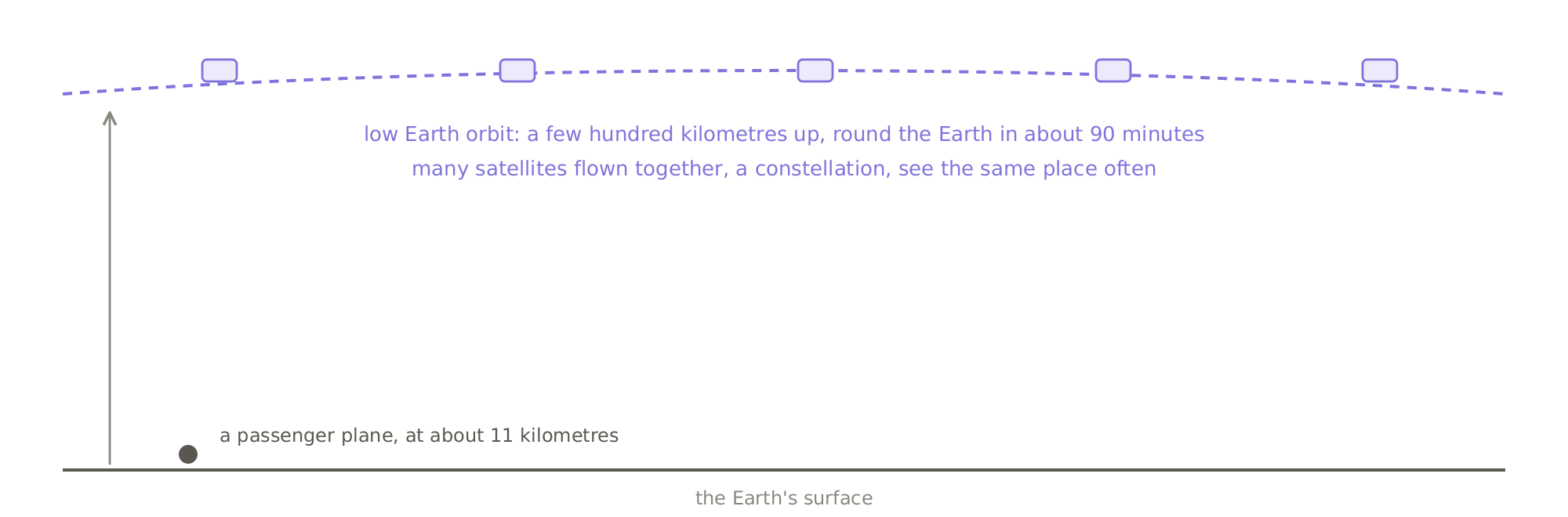
Where they fly: Earth-observation satellites circle in low Earth orbit, a few hundred kilometres up, many times higher than a passenger plane, and companies fly many together as a constellation.Where they fly: Earth-observation satellites circle in low Earth orbit, a few hundred kilometres up, many times higher than a passenger plane, and companies fly many together as a constellation.

Why start-ups can now do it. Satellites have become small and cheap. Some are the size of a suitcase. They can share a rocket with other satellites, which cuts the cost of launch. In 2020, India opened its space sector to private companies. It set up IN-SPACe, a government body that authorises and supports them.

How the money flows. Satellite companies sell images, sold by the area covered. They also sell analysis: not the picture, but the answer, such as which fields are under stress. The buyers are governments and armed forces, farming and insurance companies, mining companies, and those who watch shipping. (More on how satellite images are used for farm loans and crop insurance in Market Segment 45.1, Satellite crop monitoring, in Industry Vertical 45, Agritech.)

Tracking what is in orbit. Thousands of satellites now circle the Earth, along with many pieces of debris, such as old rocket parts. A collision can destroy a satellite. So satellite operators need to know where everything in orbit is, and when to move out of the way.

A small group of start-ups in Bengaluru now builds imaging satellites and the software that tracks objects in orbit.

Every company named here has posted software engineering jobs in India. Famous companies that don't actively hire software engineers in India are left out.

Keep reading, free

One more section is on this page: Imaging satellites and tracking what is in orbit. Sign in to read it here, in full.

Continue with Google
  • Imaging satellites and tracking what is in orbit
Imaging satellites and tracking what is in orbit

Imaging satellites

GalaxEyea company from IIT Madras with engineers in Bengaluru, is building satellites that combine radar and optical cameras. They can see through cloud and at night, as well as by day. GalaxEye has the most job postings in this Market Segment. Pixxelwith engineers in Bengaluru, builds hyperspectral satellites. They reveal crop disease, pollution and minerals. Pixxel launched its first commercial satellites in 2025. PierSightwith engineers in Bengaluru, is building radar satellites to watch ships at sea.

Tracking what is in orbit

Digantarawith engineers in Bengaluru, tracks objects in orbit, both satellites and debris, using its own sensors in space. Kayhan Spacesells software that helps satellite operators avoid collisions.

Aetosky, in Bengaluru, is another company in this area.

One company covered mainly in another Market Segment also works here:

AEREOwith engineers in Bengaluru, surveys land with drones and analyses the results. (More on it in Market Segment 8.4, Mapping and location intelligence platforms, in Industry Vertical 8, Analytics and data providers.) The picture that explains itself.

Satellites now take far more images than people can look at. So the value is moving from the picture to the answer. Which fields are under stress? What has changed since yesterday? Which ships have switched off their transponders? Ships use transponders to broadcast their position, and some switch them off to hide. AI models read the images to find these answers. India's satellite start-ups are building both the satellites and the AI models that read their pictures.

That is Earth observation: satellites that see the Earth by camera, radar and colour, and software that turns their pictures into answers. A small group of Bengaluru start-ups is building it in India.
Who they hire

Who these companies hire, and for what, is on What aerospace, defence and space companies hire for.

Privacy Terms Refunds and cancellation Shipping and delivery © 2026 ingrid.fyi · Payments by Razorpay
You're browsing as a guest. Sign in free to follow links for five minutes, once an hour.