ingrid.fyi India's software hiring trends, explained.
Sign in to ingrid.fyi with Google
Your Google account
name@gmail.com
Continue with Google
Home / Product companies / XI · Traditional industries going digital / Agritech / Satellite crop monitoring
On this page
Satellite crop monitoring Watching the field from above, before the bank lends for the season Take the farmer from the start of this Industry Vertical, who grows cotton on five acres in Telangana. The season starts with money. Before sowing, the farmer needs a loan to buy seed and fertiliser. But most Indian farmers have no credit history a bank can read. The bank cannot easily check what the farmer grows, or how good the harvest usually is.

What the bank can see is the field. Satellites pass over every field in India every few days. Their images show what is planted where, and how well it is growing. Software turns those images into information a bank or an insurer can use. This is the first way software reaches the farm: from above.
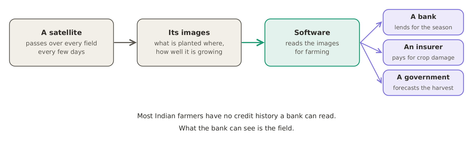
Seen from above: a satellite passes over every field every few days, its images show what is planted where and how well it is growing, and software reads them for a bank that lends, an insurer that pays for crop damage, and a government that forecasts the harvest.Seen from above: a satellite passes over every field every few days, its images show what is planted where and how well it is growing, and software reads them for a bank that lends, an insurer that pays for crop damage, and a government that forecasts the harvest.

The satellites themselves are covered elsewhere. (More on them in Market Segment 39.3, Earth observation and space surveillance, in Industry Vertical 39, Aerospace, defence and space.) So are images taken from drones and aircraft, and the maps they feed. (More on them in Market Segment 8.4, Mapping and location intelligence platforms, in Industry Vertical 8, Analytics and data providers.) This Market Segment is about the company that reads the images for farming.

Every company named here has posted software engineering jobs in India. Famous companies that don't actively hire software engineers in India are left out.

Keep reading, free

One more section is on this page: Turning satellite images into loans and insurance. Sign in to read it here, in full.

Continue with Google
  • Turning satellite images into loans and insurance
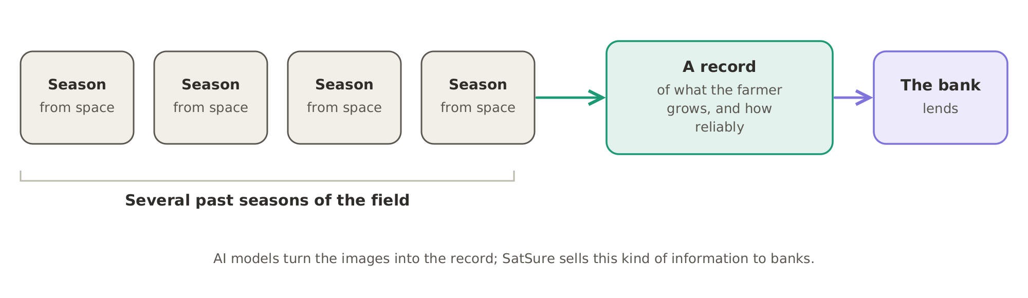
Turning satellite images into loans and insurance SatSurefounded in India, with engineers in Bengaluru, analyses satellite images to show what is planted where and how it is growing. It sells this information to three kinds of buyers: The field becomes the credit history: images of several past seasons of a field are turned into a record of what the farmer grows and how reliably, and the bank lends on that record.The field becomes the credit history: images of several past seasons of a field are turned into a record of what the farmer grows and how reliably, and the bank lends on that record. The loan decided from orbit.

Most Indian farmers have no credit history a bank can read. But their fields can be seen from space every few days. AI models turn those images into a record of what a farmer grows and how reliably. Banks then lend on that record. Back to the cotton farmer from the start of this Market Segment: before it lends, the bank can look back at several past seasons of the field from space. Satellite data is becoming the farm's credit history.

That is the first way software reaches the farm: from above, through images that let a bank lend and an insurer pay. With the loan approved, the farmer can now buy seed. Market Segment 45.2, Agribusiness and farm advisory platforms, follows that money.
Who they hire

Who these companies hire, and for what, is on What agritech companies hire for.

Privacy Terms Refunds and cancellation Shipping and delivery © 2026 ingrid.fyi · Payments by Razorpay
You're browsing as a guest. Sign in free to follow links for five minutes, once an hour.